

Utilising FME at National Broadband Ireland
How National Broadband Ireland (NBI) uses FME to manage and automate data processing for the rollout of high-speed broadband across rural Ireland. FME helps integrate and validate spatial data, keeping project management efficient and infrastructure mapping accurate throughout the deployment.

businesses and fnt are
The customer
This high-speed fibre and future-proofed network covers 1.1 million people living and working in over 564,000 premises, including 91,000 businesses and farms and some 672 schools. Equal internet access means equal opportunities for everyone, wherever they live, work or study. It is the largest telecommunications project ever undertaken by the Government of Ireland, and the largest of its kind in Europe.
The challenge
For the rollout, Ireland is divided into 227 Deployment Areas (DAs), including the offshore islands. As part of the deployment phase of the project, each DA has four phases:
1
Survey
2
Design
3
Build
4
Connection
Spatial data underpins the rollout and requires systems and processes that can integrate with each other and have the ability for data translation. It needs systems and processes that integrate with each other and can translate data between formats. FME is central to the integration of data across NBI systems in the project deployment phase.
The solution
NBI uses FME to streamline and automate data processing across each stage of its infrastructure projects, from design to build and the final supporting evidence for milestone payments. Integrating national datasets and automating quality control (QC) improves efficiency and accuracy, and supports smooth project delivery and compliance with regulatory requirements.
How FME is set up
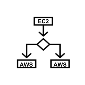
- FME Floating License Server Manager is installed on a cloud-based AWS EC2 instance dedicated to the NBI GIS team.
- Database Edition floating licences are hosted via the floating licence manager.
- FME Form (Desktop) is installed on each NBI AWS workspace, and the floating licences are accessed from there as needed.
FME use cases by stage
Design stage
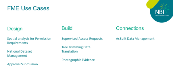
- Spatial analysis for permission requirements: FME performs spatial analysis that shows the permissions team where installation sites fall within the boundaries of private or commercial landowners.
- National datasets management: Automated processing of DGN, GML and SHP formats into NBI’s ArcGIS Enterprise geodatabase.
- Approval submission: FME collates data from several datasets to generate design reports for DECC approval before construction starts in each Deployment Area.
Build stage
- Supervised access requests: FME generates weekly access requests, with coordinates and photos, for core drilling in existing third-party chambers.
- Tree trimming data translation: LiDAR survey data shows where trees infringe on proposed cable routes and need cutting before installation. FME translates the LiDAR scans of the aerial network onto NBI’s Build Map, the single source of truth during the build stage, showing where trimming and further on-site surveys are needed, with links to the LiDAR data. This makes it easy to give clear instructions to teams on site.
- Photographic evidence QC: FME validates geotagged photos, preventing duplicates and checking proximity to infrastructure. Issues are caught before submission to DECC, avoiding resubmission and rework.
Connections stage
- AsBuilt data management: FME extracts and loads final AsBuilt data into the ArcGIS Enterprise geodatabase, giving the wider organisation access through ArcGIS Online.
National dataset management
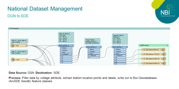
National datasets (OSI mapping, existing utility data, CSO datasets) need to be viewed by NBI staff and on-site teams alongside NBI network data in ArcGIS Online. NBI receives these datasets in a range of formats, and they need to be updated accurately with minimal downtime. The workbench below translates utility network data, received from an external source in CAD format, into NBI’s ArcGIS Enterprise geodatabase.
Seamless CAD to SDE conversion
Efficiently reads CAD files and converts the data to 31 pre-defined feature classics in the ArcGIS Enterprise geodatabase.
Efficient Large data processing
Processes large datasets quickly by reading and translating multiple CAD files at simultaneously.
Automated updates
Eliminates manual conversion and appending, giving a click-and-run process for updating the geodatabase with no downtime for users.
Supervised access requests for existing chambers
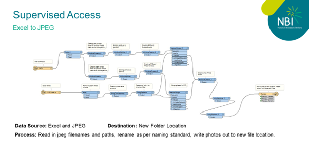
To core drill in existing third-party chambers, NBI must submit a supervised access request each week, including photos and x/y coordinates of the chamber. Requests are approved or rejected based on that information.
Quality control process
- Geotag verification: FME checks that every photo has a geotag and is within 25 metres of the chamber.
- Naming standards: FME renames photos to comply with naming standards.
This makes sure all core drilling is accurately documented and meets the data requirements, keeping operations smooth and compliant.
AsBuilt data management
Deployment Areas are divided into smaller sections called ribbons. NBI’s design partners provide AsBuilt designs in shapefile format, ribbon by ribbon. FME extracts only the relevant ribbon data from each design pack, so AsBuilt maps reflect the latest infrastructure changes in each DA. This improves the accuracy and reliability of NBI’s mapping and inventory management.
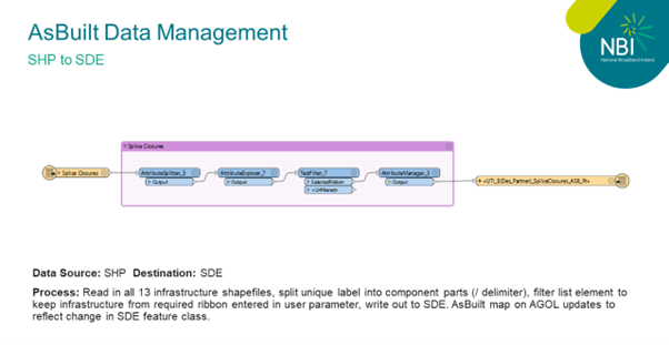
AsBuilt data process
- Division into ribbons: Deployment Areas are divided into smaller sections called ribbons.
- Incremental updates: As each ribbon is completed, NBI receives updated design packs. For example, a DA split into five ribbons (A to E) results in five separate design packs.
- Specific updates: Each design pack contains shapefiles with all DA infrastructure. FME extracts only the data for the ribbon named in the pack to the relevant feature class in the ArcGIS Enterprise geodatabase.
- Data extraction: Once all ribbons are received for a DA, FME extracts the data from the geodatabase to Excel and shapefile for reporting outside the GIS team, translating the coded domains used in SDE into a human-readable format.
AsBuilt mapping process
Selective integration: To create accurate AsBuilt maps, NBI mimics the GE Smallworld process by extracting and integrating only the updated infrastructure for the specific ribbon from each design pack.
The outcome
Together, these processes show FME’s central role in efficient, accurate and scalable data management and integration, critical to the successful delivery of NBI’s broadband rollout.
“FME is crucial to NBI’s geospatial processes, validation, and data management, enabling scalable processes essential for the deployment of the NBI Network. As the number of designed and built Deployment Areas increases, the ability to process and track large volumes of data simultaneously becomes increasingly important. FME’s interoperability capabilities ensure the seamless movement and management of data across various stages of the project.”
Brian O’Malley, GIS Manager, National Broadband Ireland
Talk to us about FME
We’ve partnered with Safe Software for over 20 years, helping organisations across Ireland and the UK automate and integrate their data.